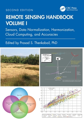
Remote Sensing Handbook, Volume I: Sensors, Data Normalization, Harmonization, Cloud Computing, and Accuracies
暫譯: 遙感手冊,第壹卷:感測器、數據標準化、協調、雲端運算與準確性
Thenkabail, Prasad S.
- 出版商: CRC
- 出版日期: 2026-06-21
- 售價: $3,210
- 貴賓價: 9.5 折 $3,049
- 語言: 英文
- 頁數: 582
- 裝訂: Quality Paper - also called trade paper
- ISBN: 1032890967
- ISBN-13: 9781032890968
-
相關分類:
地理資訊系統 Gis
海外代購書籍(需單獨結帳)
商品描述
Volume I of the Remote Sensing Handbook, Second Edition, is focused on satellites and sensors including Radar, LiDAR, Microwave, Hyperspectral, UAVs and their applications. It integrates discussions of remote sensing principles, data, methods, development, applications, and scientific and social context.
商品描述(中文翻譯)
《遙感手冊》第二版的第一卷專注於衛星和感測器,包括雷達、LiDAR、微波、高光譜、無人機及其應用。它整合了遙感原則、數據、方法、開發、應用以及科學和社會背景的討論。
作者簡介
Dr. Prasad S. Thenkabail, Senior Scientist (ST), United States Geological Survey (USGS), is a world-recognized expert in remote sensing science with major contributions in the field for nearly 40 years. He has made the list of the world's top 1% of scientists across 22 scientific fields and 176 sub-fields. Dr. Thenkabail has conducted pioneering research in hyperspectral remote sensing of vegetation, global croplands, and their water use for food security. He obtained his PhD from the Ohio State University in 1992 and has 168 peer-reviewed publications including 15 books, including this six-volume set, and over 15 major data releases such as the Landsat-derived global cropland extent product @ 30m and Landsat-derived rainfed and irrigated cropland area product @ 30 m (LGRIP30). He was recognized as a Fellow of the American Society of Photogrammetry and Remote Sensing (ASPRS) in 2023. His scientific papers have won several awards for demonstrating world-class, highest-quality research. He was a Landsat Science Team Member (2007-2011).
作者簡介(中文翻譯)
普拉薩德·S·滕卡貝爾博士(Dr. Prasad S. Thenkabail),美國地質調查局(USGS)高級科學家(ST),是一位在遙感科學領域享有世界聲譽的專家,近40年來對該領域做出了重大貢獻。他在22個科學領域和176個子領域中被列入全球前1%的科學家名單。滕卡貝爾博士在植被的高光譜遙感、全球農田及其水資源使用以確保糧食安全方面進行了開創性研究。他於1992年獲得俄亥俄州立大學的博士學位,擁有168篇經過同行評審的出版物,包括15本書籍,其中包括這套六卷本的書籍,以及超過15個主要數據發布,例如基於Landsat的全球農田範圍產品(@30m)和基於Landsat的雨養和灌溉農田面積產品(@30m,LGRIP30)。他於2023年被認定為美國攝影測量與遙感學會(ASPRS)的院士。他的科學論文因展示世界級的高品質研究而獲得多項獎項。他曾是Landsat科學團隊成員(2007-2011)。