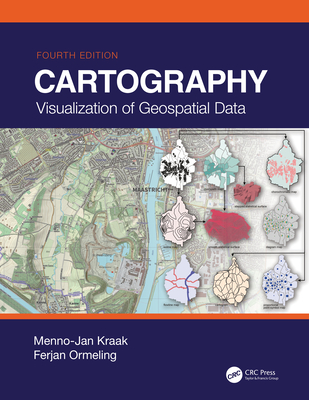
Cartography: Visualization of Geospatial Data, Fourth Edition
暫譯: 地圖學:地理空間數據的可視化(第四版)
Kraak, Menno-Jan, Ormeling, Ferjan
- 出版商: CRC
- 出版日期: 2020-07-29
- 售價: $6,290
- 貴賓價: 9.5 折 $5,975
- 語言: 英文
- 頁數: 245
- 裝訂: Hardcover - also called cloth, retail trade, or trade
- ISBN: 1138613959
- ISBN-13: 9781138613959
-
相關分類:
地理資訊系統 Gis
-
相關翻譯:
地理空間數據可視化(原著第四版) (簡中版)
海外代購書籍(需單獨結帳)
商品描述
This Fourth Edition of Cartography: Visualization of Geospatial Data serves as an excellent introduction to general cartographic principles. It is an examination of the best ways to optimize the visualization and use of spatiotemporal data. Fully revised, it incorporates all the changes and new developments in the world of maps, such as OpenStreetMap and GPS (Global Positioning System) based crowdsourcing, and the use of new web mapping technology and adds new case studies and examples. Now printed in colour throughout, this edition provides students with the knowledge and skills needed to read and understand maps and mapping changes and offers professional cartographers an updated reference with the latest developments in cartography.
Written by the leading scholars in cartography, this work is a comprehensive resource, perfect for senior undergraduate and graduate students taking courses in GIS (geographic information system) and cartography.
New in This Edition:
- Provides an excellent introduction to general cartographic visualization principles through full-colour figures and images
- Addresses significant changes in data sources, technologies and methodologies, including the movement towards more open data sources and systems for mapping
- Includes new case studies and new examples for illustrating current trends in mapping
- Provides a societal and institutional framework in which future mapmakers are likely to operate, based on UN global development sustainability goals
商品描述(中文翻譯)
這本《地圖學:地理空間數據的視覺化》第四版是一般地圖學原則的優秀入門書籍。它探討了優化時空數據的視覺化和使用的最佳方法。這一版經過全面修訂,納入了地圖世界中的所有變化和新發展,例如 OpenStreetMap 和基於 GPS(全球定位系統)的群眾外包,以及新網路地圖技術的使用,並增加了新的案例研究和範例。現在全書以彩色印刷,這一版為學生提供了閱讀和理解地圖及地圖變化所需的知識和技能,並為專業地圖製作者提供了最新地圖學發展的更新參考。
本書由地圖學領域的領先學者撰寫,是一部全面的資源,適合修習 GIS(地理資訊系統)和地圖學課程的高年級本科生和研究生。
本版新內容:
- 通過全彩圖形和影像提供一般地圖視覺化原則的優秀入門
- 討論數據來源、技術和方法論的重大變化,包括向更開放的數據來源和地圖系統的轉變
- 包含新的案例研究和範例,以說明當前地圖製作的趨勢
- 提供未來地圖製作者可能運作的社會和機構框架,基於聯合國全球發展可持續目標
作者簡介
Menno-Jan Kraak is professor of Geovisual Analytics and Cartography at the University of Twente, Faculty of Geoinformation Sciences and Earth Observation / ITC. Currently he is head of ITC's Geo-Information Processing Department. He is also serving as President of the International Cartographic Association (ICA) for the period 2015-2019. He has written more than 200 publications, among these the book Mapping Time. He is a member of the editorial board of several international journals in the fields of cartography and GIScience.
Ferjan Ormeling retired as honorary professor of Cartography at Utrecht University (where he focused his research on thematic cartography, atlas cartography and toponymy), and now works as a member of the Explokart research group at the University of Amsterdam. He advises on atlas projects on behalf of the International Cartographic Association, and teaches toponymy courses in developing countries for the United Nations Group of Experts on Geographical Names.
作者簡介(中文翻譯)
Menno-Jan Kraak 是荷蘭特溫特大學地理資訊科學與地球觀測學院(ITC)的地理視覺分析與製圖教授。目前,他擔任 ITC 地理資訊處理部門的負責人。他還在 2015 至 2019 年期間擔任國際製圖協會(ICA)的會長。他已發表超過 200 篇出版物,其中包括書籍《Mapping Time》。他是幾本國際期刊的編輯委員會成員,這些期刊專注於製圖和地理資訊科學領域。
Ferjan Ormeling 退休前是烏特勒支大學的名譽製圖教授(他專注於主題製圖、地圖集製圖和地名學的研究),現在在阿姆斯特丹大學的 Explokart 研究小組工作。他代表國際製圖協會就地圖集項目提供建議,並為聯合國地名專家小組在發展中國家教授地名學課程。